🌍 The Colourful World Map — labelled & explained
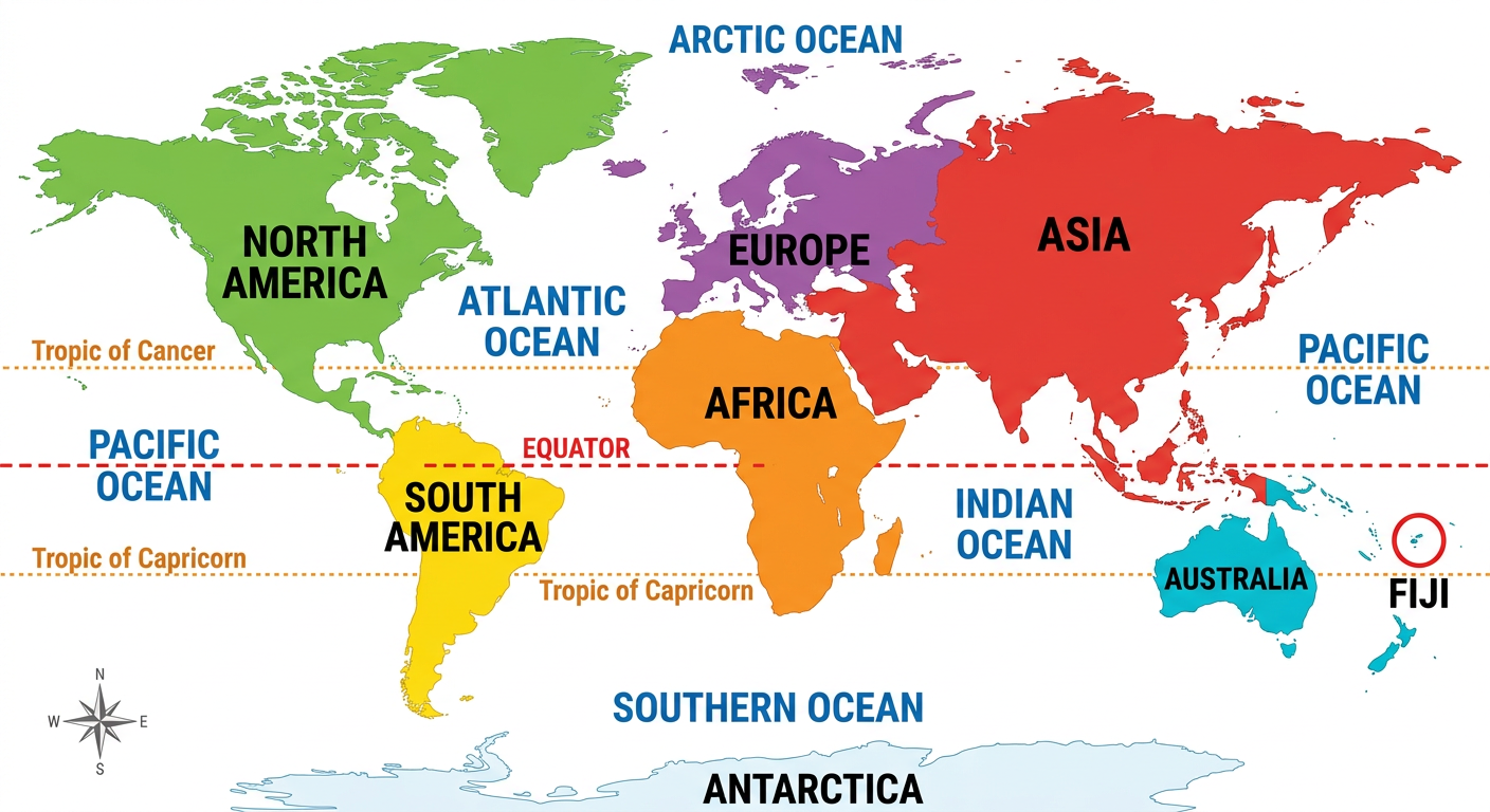
| Label on the map | What to know for the exam |
|---|---|
| ASIA | The LARGEST continent — China (capital Beijing), Japan (kimono), India (New Delhi — the girmit link to Fiji!) |
| AFRICA | The SAHARA (largest hot desert), South Africa (the “Rainbow Nation” — Mandela), Madagascar lies off it in the Indian Ocean |
| EUROPE | Home of the Caucasoids (light skin, blonde hair); Britain, Germany, France — developed countries |
| NORTH AMERICA | USA (50 states, richest country) + CANADA (second-largest country by area) + Greenland nearby (50,000 cold residents!) |
| SOUTH AMERICA | BRAZIL (largest country + Amazon rainforest) • ARGENTINA (Messi’s home) |
| AUSTRALIA | The island continent — Aborigines; states include New South Wales (largest by population) and Tasmania (island state) |
| ANTARCTICA | Frozen south — penguins live HERE, not in the Arctic! |
| PACIFIC OCEAN | The largest ocean — FIJI lies here with Vanuatu, Tonga, Samoa, Kiribati (Micronesia) and NZ (Polynesia/Maori) |
| EQUATOR | 0° latitude — the hot, wet TROPICAL belt; Tropics of Cancer & Capricorn sit 23.5° either side; polar circles at 66.5° |
🏝 The Fiji Map — our islands explained
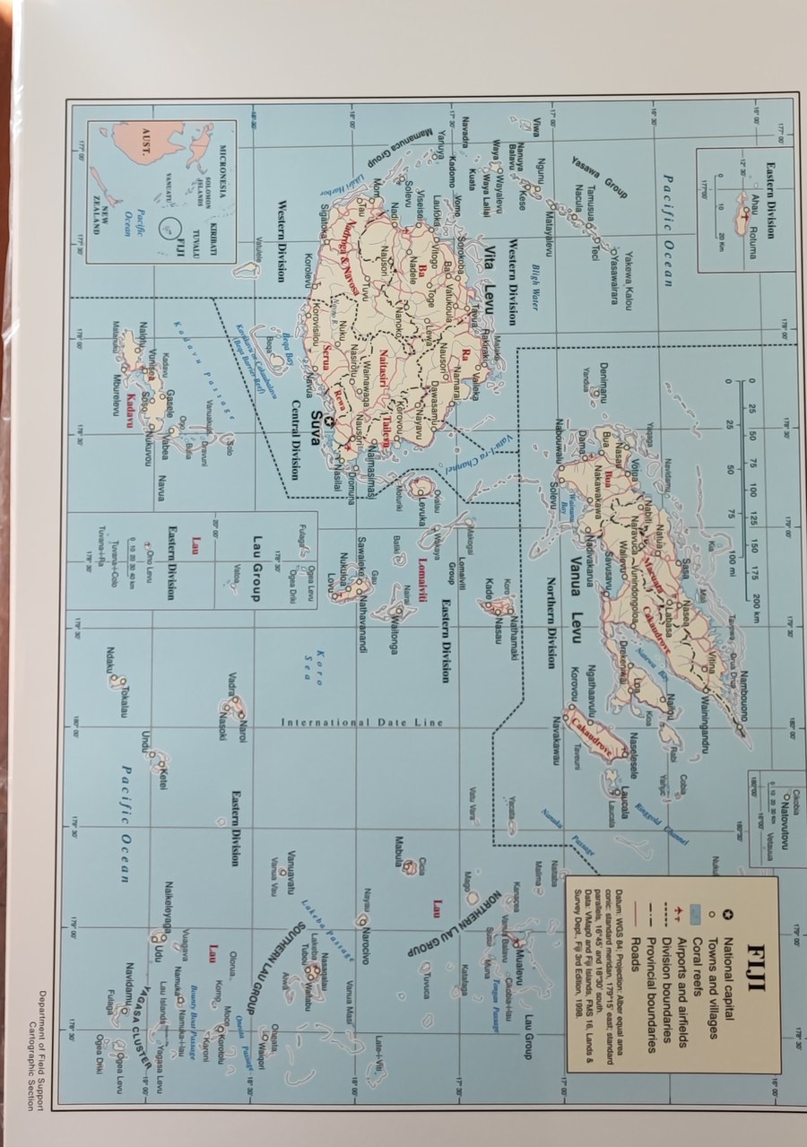
| Island / label | Know this |
|---|---|
| VITI LEVU | Biggest island — SUVA (the capital) is here |
| VANUA LEVU | Second-biggest island |
| YASAWA GROUP | Tourist islands of the west |
| LAU GROUP | Eastern islands |
| NEIGHBOURS | Vanuatu (west) • Tonga (east) • Samoa (north) • New Zealand (south) |
| REGION | Fiji = MELANESIA (with PNG, Solomon Is., Vanuatu, New Caledonia); Kiribati = Micronesia; Samoa/Tonga = Polynesia |
| FIJI FACTS | Independence 10 Oct 1970 (PM Ratu Sir Kamisese Mara) • first President Ratu Penaia Ganilau (1987) • island life = fishing, tourism, cyclones & sea-level rise |
🗺 Africa Map — exam links
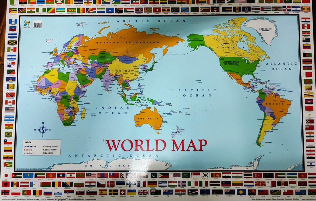
Africa quick facts: the SAHARA is the largest hot desert (dry climatic region) • South Africa is the “Rainbow Nation” of Nelson Mandela • the Negroid peoples (dark skin, curly hair) are Africa’s majority group • Madagascar (island in the Indian Ocean) is a recurring mapping answer.
🧠 The Key Concepts Map — the whole syllabus in one picture
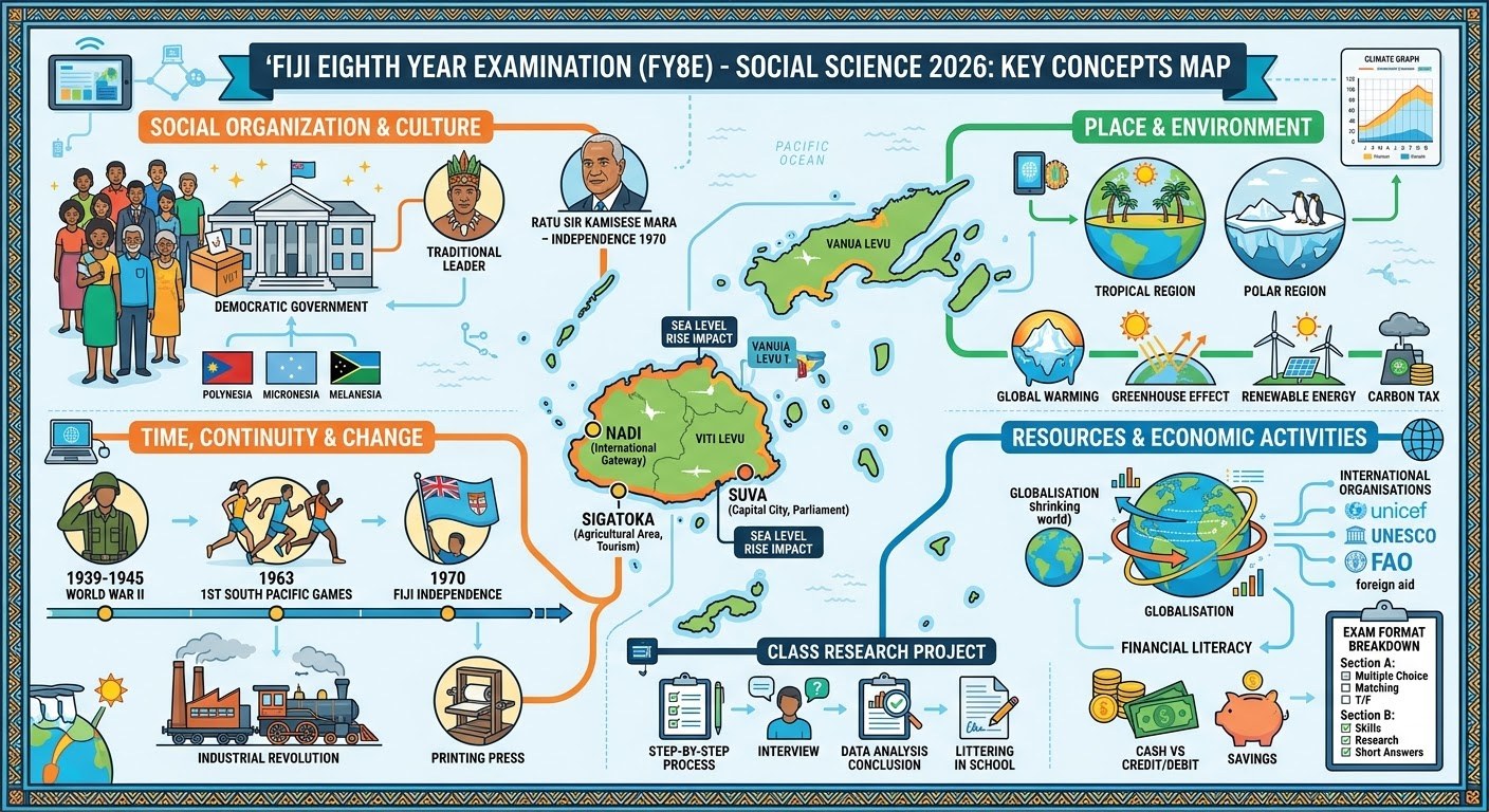
Map-reading recipe for Resource Interpretation: ① find the letter on the map ② match its continent/ocean ③ recall the clue (“largest hot desert → Sahara”) ④ eliminate distractors in the word list. Practise with all 8 real exam maps in the posters and the 30 downloadable papers.